Resource Library
Bike Walk RVA aims to provide a resource hub for walking and biking advocacy, infrastructure, and community engagement. This free and growing collection of resources provides the latest information on bike and pedestrian infrastructure, local advocacy efforts, and strategies to promote active transportation and safer streets throughout the Richmond region.
Richmond Bike Network Maps
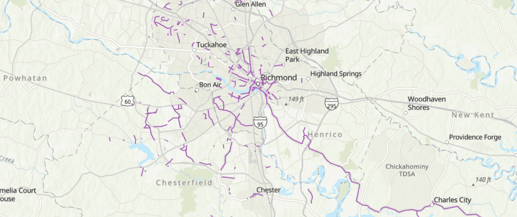
- Regional Bike Infrastructure Map: this PlanRVA map is updated when new infrastructure comes online
- RRTPO’s BikePed 2045 Interactive StoryMap: this map shows existing and proposed bike lanes and multi-use paths with the goal of creating a regionally connected network of safe cycling infrastructure by 2045
- PDF: Bike Walk RVA’s 2025 Map of the Richmond bike network
Regional ‘Near Miss’ Dashboard

The Near Miss Dashboard project was created to be a shareable online space for the public to submit close call events and road hazards to a database for analysis and mapping display. The National Safety Council defines a Near Miss as an unplanned event that does not result in injury or death, but could have. For this reporting tool, PlanRVA recognizes that many collisions go unreported to police.
This reporting tool aims to capture any event not formally reported. Near misses and collisions are differentiated in the reporting form. The data collected from this dashboard will enable PlanRVA to incorporate near misses and collisions that go unreported to police into project scoring models, planning decisions, and educational efforts. The information collected helps understand travel patterns, travel behavior, perceptions of safety, and focusing traffic safety enforcement actions.
Regional active Transportation Plans
- City of Richmond’s Office of Equitable Transit & Mobility and their Richmond Connects Plan
- Henrico County’s Arrive Alive Transportation Safety Improvement Plan
- VDOT’s Bike and Pedestrian Program
- Chesterfield County’s Active Transportation Plan
Watch the Bike Walk Webinar about Chesterfield’s 2025 Update below:
Electric Bike Educational Resources
- E-Bike Smart Guide to Safe Riding
- “Should You Buy Your Kid and E-Bike?”, People for Bikes
Vision Zero
- 2025 Vision Zero Scorecard Report, presented by Bike Walk RVA at the October Safe and Healthy Streets Commission meeting
- 2021 Richmond Vision Zero Scorecard Report
- City of Richmond’s Vision Zero Dashboard Webpage for safety data and the Vision Zero Action Plan
- Henrico County’s Arrive Alive Henrico Campaign Homepage